iTAK 2.9.0
Continue to app
Free Version
Publisher Description
--- We added so much in this release --
**Compatible with ALL TAK ecosystem (TAK server, WinTAK, ATAK, WebTAK)**
The Team Awareness Kit (TAK) (known as the Tactical Assault Kit in the Department of Defense) application:
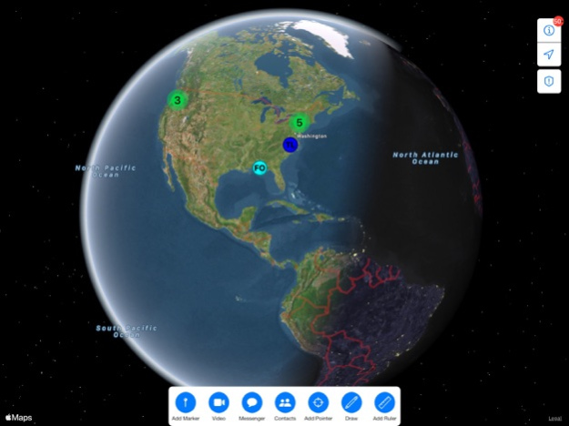
iTAK is a collaborative geospatial application to see your teams’ locations, sensor information, videos, chat, and more in real-time. iTAK supports Department of Defense (DoD) and commercial sector standards for icons, sensor information, and communication. Data can be pre-loaded into iTAK or downloaded from the network (via TAK Server) when available.
iTAK capabilities include:
• Online and offline mapping (most standard formats), download the maps right in the app
• Blue force / team tracking (BFT)
• Collaborative mapping, including points, drawings, locations of interest
• Import and display of KML, KMZ, GeoPDF overlays
• Location marking, sharing, with photo tagging
• Chat, file sharing, photo sharing
• Live video streaming with the ability to share video links
• Spotted map to mark and share multiple locations across your map
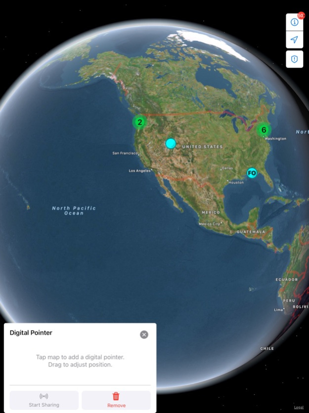
• Digital pointer to rapidly mark and share items on the map with your team
• Navigation-walking/hiking, driving, also useful flying and air-ground coordination
• Center on self or other objects (e.g. another person in the network)
• Range, bearing measurement tools
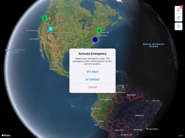
• Team Emergency Beacons
• Customizable toolbar
• 3D perspective
• All data is secured and fully compatibility with the TAK ecosystem (ATAK, TAK Server, WinTAK)
• Useful for law enforcement, first responders, hunting, fishing, ornithology, wildlife site survey
System Requirements
Operating System: iOS version 16 and later.
Apr 24, 2024
Version 2.9.0
----New Features----
Files Tool
Files loaded are now centralized into the files tool, rather than being maintained by each tool individually
Files can be loaded from device memory or downloaded from a remote link
Users can view properties of loaded files such as the size and creation date
Files are sorted into appropriate subfolders based on their file extension.
Marker Palettes / Icon Sets
User can load an icon set that has a valid iconset.xml
Note: Marker Palettes without an iconset.xml are not supported at this time
Markers can be updated to use icons from a loaded icon set.
Included is FEMA, Default, Falconview, Incident Management, Numbers, OSM, Public Safety Air, Responder, and GeoOps iconsets.
Point Dropper
Adds Point Dropper tool to successively drop markers.
Merged Spotted Map tool into Point Dropper tool.
----Resolved Issues----
Fixed an issue where multiple bloodhound lines could be generated if the first was not correctly terminated.
Fixed toolbar items not respecting specified order.
Fixed overlays flickering when interacting with the map using the satellite or hybrid map sources.
Fixed overlays not being able to be downloaded from URLs that do not contain a file extensions.
Fixed not be able to set the color before drawing a shape.
Fixed geofence notification not respecting the updated shape name.
Fixed marker with attachments, overlays, and files failing to share over the mesh network.
Fixed private chats appearing a general with all the messages showing as sent from the current user when the recipient Contact stales out.
Fixed overlays appearing below a custom map source like Google Hybrid.
Fixed an issue where it was not possible to select contacts to add to a group chat.
Fixed marker icons not being a uniform size.
Fixed an issue where a videos url was incomplete when downloaded from a server.
Fixed an issue where certain settings were not being saved.
Fixed video playback not recovering after a connection is lost and regained.
----Improved Features----
TAK Server Configuration
Updated the UI to follow modern iOS design system.
Updated the UI to better show that status of the connection.
Configurations add can now be edited.
Go To
Search history is saved for addresses.
Updated UI to be in line with navigation.
Adds the options to drop an unknown ground marker at the selected location.
Navigation
Search history is saved for addresses.
About iTAK
iTAK is a free app for iOS published in the Recreation list of apps, part of Home & Hobby.
The company that develops iTAK is United States Department of the Army, TAK Product Center. The latest version released by its developer is 2.9.0.
To install iTAK on your iOS device, just click the green Continue To App button above to start the installation process. The app is listed on our website since 2024-04-24 and was downloaded 3 times. We have already checked if the download link is safe, however for your own protection we recommend that you scan the downloaded app with your antivirus. Your antivirus may detect the iTAK as malware if the download link is broken.
How to install iTAK on your iOS device:
- Click on the Continue To App button on our website. This will redirect you to the App Store.
- Once the iTAK is shown in the iTunes listing of your iOS device, you can start its download and installation. Tap on the GET button to the right of the app to start downloading it.
- If you are not logged-in the iOS appstore app, you'll be prompted for your your Apple ID and/or password.
- After iTAK is downloaded, you'll see an INSTALL button to the right. Tap on it to start the actual installation of the iOS app.
- Once installation is finished you can tap on the OPEN button to start it. Its icon will also be added to your device home screen.
